

Last Updated: May 16, 2026
Navigating the open waters requires reliable tools, and perhaps none is more fundamental than the marine compass. Despite modern technological advancements, understanding compass basics remains essential for anyone venturing offshore. This guide explores everything from how a magnetic compass works to proper binnacle installation, ensuring you can navigate confidently even when electronics fail.
Marine compasses are crucial for both novice and experienced sailors, providing a reliable backup when electronic devices falter and playing a pivotal role in safe navigation.
What is a marine compass, and why is it essential for boat navigation?
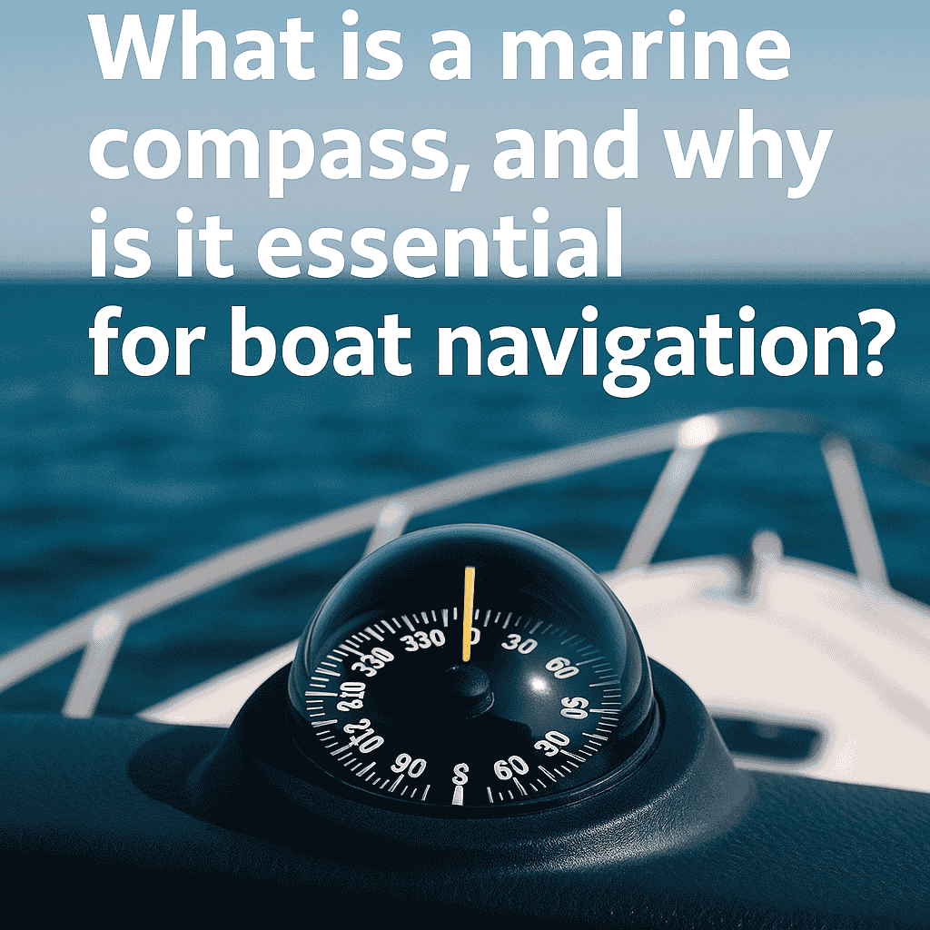
A marine compass is a specialized navigational tool designed specifically for maritime environments. Unlike standard compasses, marine compasses are built to withstand the constant motion, vibration, and harsh conditions found at sea.
Marine Compass Essentials
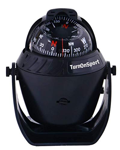
Boat Compass Dash Mount Flush – Boating Compass Dashboard Suction – Navigation Marine Compass Boats Surface Mount – Illuminated Dashboard Compass Ship – Electronic Sea Compass Suction Cup (Black)
Boat Compass Dash Mount Flush – Boating Compass Dashboard Suction – Navigation…
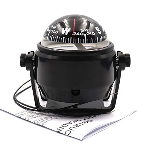
DETUCK Boat Compass Dashboard Marine Compass for Boat Dash Mount with Night Lighting
DETUCK Boat Compass Dashboard Marine Compass for Boat Dash Mount with Night…

Keenso Boat Compass, Waterproof Marine Compass for Boats Dash Mount Hiking Camping Magnetic Compass for Boat Caravan Truck
Keenso Boat Compass, Waterproof Marine Compass for Boats Dash Mount Hiking Camping…
The fundamental principle remains unchanged since ancient times – a magnetized needle that always points toward magnetic north, providing sailors with directional guidance regardless of visibility conditions. This reliable instrument has been around for centuries, serving as the primary means of direction-finding long before GPS and electronic navigation systems became available.
According to a 2023 survey, 85% of long-distance voyaging sailors still prefer having a magnetic compass onboard despite having advanced electronic systems.
Difference Between a Marine Compass and Other Navigational Tools

While other navigational tools like GPS, radar, and chartplotters provide precise positional information, a marine compass is uniquely focused on directional guidance. The compass is often considered the most fundamental navigational instrument because it directly indicates which way the boat is pointing relative to magnetic north.
Unlike electronic devices that calculate position based on satellite signals or radio waves, a magnetic compass physically responds to Earth’s magnetic field, requiring no external power source. This independence makes the compass exceptionally reliable when used correctly.
Maritime compasses are specifically designed with features that accommodate a boat’s motion. They typically include dampening systems that prevent the compass card or compass needle from swinging wildly in rough seas, allowing for stable readings even in challenging conditions. Additionally, steering compasses found near the helm are often larger and more easily readable from a distance than handheld varieties.
The unique mounting systems and fluid-filled housing of marine compasses also distinguish them from their land-based counterparts, making them suited to the specific demands of nautical navigation.
Understanding the Relationship Between Magnetic North and True North
One of the most important compass basics to understand is that a magnetic compass doesn’t point to true north (geographic north or the North Pole) but rather to magnetic north. The Earth’s magnetic field creates a magnetic north pole that is different from the geographic North Pole.
This difference between true and magnetic north is called magnetic variation (or declination) and varies depending on your location on Earth. For proper navigation, sailors must understand and account for this variation when plotting courses on nautical charts.
Magnetic variation changes both by location and over time as the Earth’s magnetic field slowly shifts. In some areas close to the magnetic poles, this variation can be substantial – up to 30 degrees or more. Nautical charts indicate the local magnetic variation and annual rate of change, allowing navigators to calculate the current variation.
When using compasses for navigation, this correction must be applied to convert between compass bearings and true bearings. The traditional navigator’s saying “variation east, magnetic least; variation west, magnetic best” helps remember how to apply these corrections when converting between true and magnetic headings.
Reasons Every Boat Needs a Reliable Compass Despite Modern Technology

Despite the proliferation of sophisticated electronic navigation systems, a reliable magnetic compass remains essential equipment for any boat. Electronic systems depend on power sources that can fail, satellite signals that can be lost, and complex components that can malfunction.
The magnetic compass, with its simple operating principle based on magnetism, continues to function regardless of these potential issues. When all else fails, the compass is often the last remaining tool to help sailors find their way home.
Beyond serving as an emergency backup, using the compass regularly develops and maintains essential navigational skills.
Understanding how to take bearings, plot courses, and navigate using basic tools provides a fundamental understanding of maritime navigation that makes a sailor more capable and confident. Many experienced mariners insist that relying exclusively on electronic navigation creates dangerous dependencies and skill gaps. Maintaining proficiency with compass navigation ensures that sailors can safely navigate under any circumstances, making it not just a backup tool but an essential skill for competent seamanship.
Impact of Magnetic Compass Deviation on Sailing Boat Navigation
While magnetic variation is a global phenomenon related to the difference between magnetic and true north, compass deviation is specific to each boat.
Deviation refers to the error in compass readings caused by magnetic influences within the vessel itself. Unlike variation, which can be predicted and remains constant for a given location, deviation changes with the boat’s heading and is unique to each vessel’s magnetic signature. Understanding and accounting for deviation is crucial for accurate navigation when sailing.
Compass deviation can significantly affect navigational accuracy if not properly addressed. A deviation of just a few degrees can lead a vessel miles off course during a long passage. Professional sailors and navigators understand that accurately measuring and compensating for deviation is essential for safe navigation.
The process of identifying and reducing deviation is known as compass adjustment, and on larger vessels, this is performed by a specialized compass adjuster who uses various techniques to minimize the magnetic interference affecting the compass.
Identifying Common Causes of Compass Deviation on Boats
Several factors contribute to compass deviation aboard vessels. The most significant sources are ferrous metals (iron and steel) used in the boat’s construction. Engine blocks, steel hulls, and metal fittings all create magnetic fields that can interfere with the compass needle. Electronic equipment near the helm can also generate magnetic fields that distort compass readings. Even seemingly minor items like screwdrivers or portable speakers placed near the compass can cause temporary deviation.
Modern boats typically contain more potential sources of magnetic interference than wooden vessels of the past. Speakers, electric motors, wiring harnesses, and electronic instruments all create magnetic fields that can affect compass readings. Additionally, items that become magnetized over time, such as steel bulkheads or engine components, may gradually change the magnetic environment around the compass. This means that deviation can change over time, requiring periodic verification and adjustment. Careful attention to the placement of magnetic objects near the compass and regular checks of compass accuracy are essential practices for serious mariners.
Methods to Identify and Measure Compass Deviation
Measuring compass deviation requires comparing the compass reading to a known,, accurate heading. The traditional method involves taking bearings on distant landmarks or celestial objects whose true bearings are known, then comparing these readings to what the compass shows. Alternatively, one can sail or motor on various headings while comparing the compass reading to an accurate reference like a properly calibrated gyrocompass or GPS course over ground (when there is no current or leeway).
A systematic approach to measuring deviation involves steering the vessel in a complete 360-degree circle, stopping at regular intervals (typically every 15 or 30 degrees) to record the compass reading and the corresponding true or magnetic heading from a reference source. These measurements should be taken with all normal electronic equipment operating as it would during regular use, as this equipment contributes to the vessel’s magnetic signature. The difference between the compass reading and the known accurate heading is the deviation for that particular heading. By recording these deviations at regular intervals around the compass rose, a complete picture of the compass errors emerges.
Creating and Using a Deviation Card for Your Boat
Once deviation has been measured at various headings, the results should be recorded on a deviation card. This small chart shows the correction that needs to be applied to compass readings at different headings. For example, if the deviation is +5° when heading north, the card would indicate “+5°” next to “N”. Deviation cards are typically mounted near the compass for easy reference by the helmsman. Professional navigators use these cards to make quick mental adjustments when steering or taking bearings.
Using a deviation card becomes second nature with practice. When the helmsman is asked to steer a magnetic course of 045°, they would check the deviation card to see what compass heading corresponds to that magnetic course.
If the deviation is ° at that heading, they would steer 042° on the compass to maintain the desired magnetic course of 045°. Similarly, when taking bearings with the compass, the navigator applies the appropriate deviation correction before plotting the bearing on a chart. This systematic approach to accounting for compass errors ensures accurate navigation despite the inherent limitations of magnetic compasses aboard vessels with magnetic influences.
Different Types of Marine Compasses for Navigational Use
Several types of marine compasses are available to sailors, each with distinct advantages for specific navigational purposes. The most common is the traditional liquid-filled magnetic compass, which uses a magnetized needle or card suspended in fluid to dampen movement in rough seas. These remain the standard for most recreational and many commercial vessels due to their reliability and simplicity.
More advanced vessels might employ gyrocompasses, which use gyroscopic principles rather than magnetism to determine direction. Unlike magnetic compasses, gyrocompasses point to true north rather than magnetic north, eliminating the need to correct for variation.
Electronic fluxgate compasses represent a hybrid approach, using electronic sensors to detect the Earth’s magnetic field. These can be integrated with autopilot systems and provide digital readouts that are easier to interface with other navigational electronics. For special applications, there are also hand-bearing compasses designed specifically for taking bearings of landmarks or celestial objects. Each type of compass has specific applications in maritime navigation, and many serious vessels carry multiple types to serve different navigational needs and provide redundancy.
Benefits of Binnacle-Mounted Compasses
The binnacle is a specialized mounting system for the ship’s steering compass, typically positioned directly in front of the helm station. This maritime fixture serves multiple purposes: it securely holds the compass at an appropriate height and angle for the helmsman, it protects the delicate instrument from damage, and it often incorporates features to reduce magnetic deviation.
Traditional binnacles on larger vessels may include chambers for compensating magnets or soft iron correctors that help neutralize the vessel’s magnetic influences.
Binnacle-mounted compasses offer several advantages over other compass installations. Their elevated position makes them easily visible to the helmsman while steering, reducing the need to look away from the course ahead.
The substantial construction of a proper binnacle provides excellent protection from impacts and the elements. Additionally, the distance from the deck created by the binnacle helps isolate the compass from some magnetic interference from the vessel. On traditional ships, elaborate binnacles became symbols of navigational importance, often crafted from brass and incorporating oil lamps for nighttime illumination. Modern binnacles maintain these functional advantages while incorporating contemporary materials and design elements.
Comparison of Handheld and Fixed Compasses for Maritime Navigation
Handheld compasses serve different navigational purposes than fixed steering compasses. While the fixed compass at the helm primarily indicates the boat’s heading, handheld compasses excel at taking bearings of distant landmarks, which is essential for position fixing and coastal navigation. These portable instruments can be held at eye level to align precisely with landmarks, creating more accurate bearings than would be possible with a fixed compass. Hand-bearing compasses typically include sighting mechanisms like prisms or vanes that allow the navigator to view both the compass reading and the distant object simultaneously.
Fixed compasses, whether mounted in a binnacle or directly on the boat’s centerline, provide continuous heading information that’s critical for steering a consistent course. These instruments are designed for stability and readability in all conditions.
They typically have larger cards or dials that can be easily read from the helm position, even in rough seas or low light. While both types of compasses detect magnetic north using magnetized needles, their different designs and mounting systems optimize them for their specific navigational roles. Most serious cruising vessels carry both types to cover all navigational needs.
Digital vs. Traditional Magnetic Compasses for Modern Boats
The debate between digital and traditional magnetic compasses represents a classic navigation dilemma. Digital compasses, including fluxgate and electronic compasses, offer features like digital readouts, integration with autopilots, and the ability to compensate electronically for deviation. These modern instruments can display heading information on multiple screens throughout the vessel and can even record heading data for later analysis. Some advanced models include rate-of-turn indicators and can be calibrated automatically by performing specific turning patterns.
Traditional magnetic compasses, despite their ancient design principles, continue to offer compelling advantages. Their operation requires no power source, making them completely independent and reliable during electrical failures. The direct magnetic coupling between the Earth’s magnetic field and the compass needle eliminates the potential for software glitches or sensor failures.
Many experienced mariners maintain that the fluid movement of a traditional compass card provides intuitive information about the boat’s turning motion that digital displays cannot match. For these reasons, maritime regulations typically require vessels to carry a traditional magnetic compass regardless of what electronic navigation equipment is installed. The wisest approach combines both technologies, leveraging the advantages of digital compasses while maintaining the traditional magnetic compass as the final backup.
Methods for Reading and Taking Bearings with a Boat Compass
Taking accurate bearings is a fundamental skill in maritime navigation that requires proper technique. When using a compass to determine the direction to a landmark, the navigator must align the compass properly with the object while minimizing parallax errors. With a hand-bearing compass, this typically involves holding the instrument at eye level and using the sighting mechanism to align with the target. For a fixed compass, the entire boat must be turned until the lubber line (the reference mark indicating the boat’s heading) aligns with the desired landmark, or a bearing must be taken from a compass equipped with a rotating bearing ring.
Accurate compass readings require attention to posture and positioning. The navigator should stand directly behind or in front of the compass, keeping the sighting line and their eye aligned with the compass centerline. Metal objects like watches, knives, or phones should be kept away from the compass during bearings, as they can cause temporary local magnetic distortion. When recording bearings, standard practice is to note them in three-digit format (e.g., 045° rather than 45°) to avoid confusion. Professional navigators typically take multiple bearings of different landmarks within a short timeframe to establish a more reliable position fix.
Interpreting the Compass Card and Rose for Navigation..
The compass card is the circular dial inside the compass that rotates to always point north and south. On most marine compasses, this card displays the 360-degree system, with north at 000° or 360°, east at 090°, south at 180°, and west at 270°. Traditional compass cards also show the 32 points of the compass rose (North, North by East, North-Northeast, etc.), though modern navigation primarily uses the degree system. Understanding how to read the compass card is essential for accurate navigation, as even small errors in reading can lead to significant course deviations over distance.
The compass rose found on nautical charts is a visual representation of directional information that corresponds to the compass card. Chart roses typically show both true and magnetic directional systems, with the outer ring representing true north (aligned with the chart grid) and the inner ring showing magnetic north with local variation applied.
The compass rose on charts also indicates the local magnetic variation, with a note showing the difference between true and magnetic north for that location. Navigators must use the appropriate ring on the compass rose when transferring bearings between the compass and the chart, accounting for both variation and deviation to avoid navigational errors.
Techniques for Accurate Bearings of Landmarks
When taking bearings of landmarks for position fixing, accuracy is critical. The technique begins with identifying distinctive landmarks that appear on the nautical chart. Ideal targets include lighthouses, prominent buildings, mountain peaks, or navigational buoys. The navigator then uses either a hand-bearing compass or the ship’s compass with a bearing mechanism to measure the magnetic direction to the landmark. This process should be repeated for at least two (preferably three) different landmarks to establish a reliable fix through triangulation.
For maximum accuracy when using a hand-bearing compass, the navigator should brace themselves against the boat’s structure to minimize the effects of motion. The bearing should be taken quickly and repeated several times to confirm consistency, especially in rough conditions. When using the boat’s steering compass, it’s important to note that bearings taken from different positions on the vessel may have different deviation errors.
Professional navigators establish specific compass-taking positions on their vessels and measure the deviation at these positions separately from the steering compass. This attention to detail ensures that bearings used for position fixing are as accurate as possible.
Converting Compass Bearings to Courses on Nautical Charts
Converting the bearings taken with a compass to usable information on nautical charts requires understanding the relationship between compass, magnetic, and true directions. A bearing taken with a compass must first be corrected for deviation using the vessel’s deviation card. This converts the compass bearing to a magnetic bearing. Next, the magnetic bearing must be adjusted for variation to convert it to a true bearing, which can
Frequently Asked Questions
What are the essential features to look for in a marine compass?
A reliable marine compass should include features like a dampening system to stabilize the compass card in rough seas, a clear and large display for readability, and durable construction capable of withstanding maritime conditions. It should also have a deviation card slot and be easy to adjust for local variation.
How can I minimize compass deviation on my boat?
To minimize compass deviation, ensure that all metal objects and electronic equipment are positioned away from the compass. Regularly check the compass accuracy by measuring deviation against known references, and use soft iron rods or compensating magnets if necessary to correct interference.
Why is regular compass calibration important?
Regular compass calibration is crucial because it helps maintain accurate readings, noting any changes in a boat’s magnetic field due to new equipment or shifts over time. By performing routine checks, you can ensure accurate navigation and avoid significant errors during sea voyages.
How does a gyrocompass differ from a magnetic compass?
A gyrocompass points to true north by utilizing the principles of gyroscopic motion, whereas a magnetic compass points to magnetic north based on Earth’s magnetic field. Gyrocompasses are not affected by magnetic fields and are often used in conjunction with autopilot systems.
Can a digital compass entirely replace a traditional magnetic compass?
While digital compasses offer many advanced features and integration possibilities, a traditional magnetic compass is required on most vessels due to its independence from power sources and superior reliability. A balanced approach incorporating both technologies ensures comprehensive navigational capabilities.
What should I do if my compass malfunctions at sea?
If your primary compass malfunctions, switch to a backup compass if available and use other navigational aids like GPS or charts to maintain course. It’s important to regularly practice manual navigation techniques so you’re prepared to handle such situations without relying solely on electronic tools.
📅 Last updated: