

Mastering marine navigation is essential for every boater’s safety and confidence on the water. Whether you’re cruising familiar waters or exploring new territories, understanding how to use a compass on a boat alongside modern GPS navigation systems provides crucial redundancy and precision.
Marine Navigation Tools
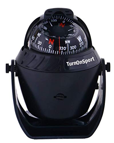
Boat Compass Dash Mount Flush – Boating Compass Dashboard Suction – Navigation Marine Compass Boats Surface Mount – Illuminated Dashboard Compass Ship – Electronic Sea Compass Suction Cup (Black)
Boat Compass Dash Mount Flush – Boating Compass Dashboard Suction – Navigation…
VIEW LATEST PRICE
Ritchie Navigation Flush Mount Compass, Black (F-50)
Ritchie Navigation Flush Mount Compass, Black (F-50)
VIEW LATEST PRICE
Marine Compass, Car Marine Navigation Compass with Adjustable Mounting Bracket, Car Marine Accessories, Marine RV Truck Accessories
Marine Compass, Car Marine Navigation Compass with Adjustable Mounting Bracket, Car Marine…
VIEW LATEST PRICEThis comprehensive guide will walk you through everything from basic compass principles to advanced navigational techniques, ensuring you can find your way even when technology fails.
Let’s explore how these fundamental tools work together to keep you on course during your maritime adventures.
What are the basics of using a marine compass for boat navigation?

A marine compass serves as the cornerstone of traditional navigation, providing reliable direction information regardless of electronic system availability.
Unlike digital tools, a magnetic compass requires no batteries or signals, making it an indispensable primary or backup navigation tool for responsible boaters.
Understanding how your boat’s compass works and its relationship to both magnetic north and true north is fundamental knowledge that every navigator should possess.
The marine compass has guided mariners for centuries before the advent of electronic navigation, and its principles remain unchanged despite our technological advances.
How does a magnetic compass work on a boat?

A magnetic compass works by responding to Earth’s magnetic field, with its needle aligning with the magnetic lines of force that run between the magnetic north and south poles.
Unlike a regular land compass, a marine compass is specifically designed to remain stable despite a boat’s constant motion on water. The compass contains a magnetized needle or card that floats in a liquid-filled housing, which helps dampen oscillations caused by waves and boat movement.
This fluid-dampening system allows the compass to maintain a steady reading of your direction of travel even in rough conditions. The compass needle always points toward magnetic north, not the geographic North Pole, an important distinction in navigation.
Most marine compasses feature a compass rose marked with cardinal directions (north, south, east, west) and degree measurements from 0 to 359, allowing for precise compass headings during your journey.
What are the differences between a marine compass and a regular compass?
Marine compasses differ significantly from regular hand-held compasses in several important ways. First, a marine compass is designed to be mounted permanently on your boat, typically at the helm where the navigator can easily reference it while steering.
Unlike regular compasses, marine compasses include built-in compensation systems to adjust for the boat’s own magnetic field, which can distort readings.
This process, known as compass deviation correction, is crucial for accurate navigation. Marine compasses also feature larger, more visible compass roses and illumination systems for nighttime navigation.
Additionally, high-quality marine compasses incorporate gimbaled mounting systems that keep the compass card level regardless of the boat’s pitch and roll, ensuring consistent readings even in choppy waters.
These specialized features make marine compasses more expensive than regular compasses, but the investment is essential for safe boating in various conditions, especially when electronic navigation aids like GPS receivers might fail.
How do I read compass bearings correctly while boating?

Reading compass bearings correctly is a fundamental skill for marine navigation. To use your compass effectively, you must understand that the compass heading represents the direction your boat is pointing, measured in degrees from 0° (north) clockwise to 359°.
When taking a bearing to a landmark, you align the boat’s lubber line (the reference mark on the compass) with the direction you wish to travel or the object you’re observing. Modern marine compasses typically display headings in degrees rather than cardinal directions, allowing for more precise navigation.
When reading your boat’s compass, maintain your natural posture at the helm to avoid parallax errors that can occur if viewing the compass from an angle. It’s also crucial to understand that compass bearings reference magnetic north, not true north, which requires conversion when working with nautical charts.
Many experienced navigators on boating forums recommend practicing compass reading in calm, familiar waters before relying on these skills in challenging navigation situations.
How do I take accurate compass bearings while navigating my boat?
Taking accurate compass bearings is essential for precise navigation and position fixing on the water. This skill allows you to determine your location, plot courses, and navigate safely even when modern electronic navigation systems are unavailable.
Mastering the technique of taking bearings requires practice and understanding of both your equipment and the marine environment. The process involves identifying visible landmarks, measuring their direction relative to magnetic north, and using this information to determine your position or establish a course.
Accurate bearings form the foundation of traditional navigation methods that have guided mariners for centuries and continue to serve as reliable backups to modern GPS technology.
What is the proper technique for taking a bearing to a landmark?
The proper technique for taking a bearing to a landmark begins with selecting a clearly identifiable object like a lighthouse, distinctive shoreline feature, or navigational aid.
To take a bearing, align your boat’s compass with the chosen landmark by pointing the boat directly at it, or by using a hand-bearing compass specifically designed for this purpose.
When using a hand-bearing compass, hold it at eye level, align the sighting wire or notch with the landmark, and read the degree marking where the compass needle intersects the compass rose.
For maximum accuracy, take bearings to at least three different landmarks, preferably separated by 30-60 degrees, which allows you to triangulate your position on a chart.
Many experienced navigators on iboats boating forums recommend practicing this technique regularly to maintain proficiency. Remember that distant landmarks provide more accurate bearings than close ones, as small errors in bearing measurement result in larger position errors when the landmark is nearby.
The ability to quickly and accurately take a bearing is an invaluable skill that enhances your overall marine navigation capabilities.
How do I convert between true north and magnetic north bearings?
Converting between true north and magnetic north bearings is a critical navigation skill since nautical charts reference true north while your magnetic compass points to magnetic north.
The difference between these two north references is called magnetic variation (or declination) and varies depending on your geographic location.
To convert from magnetic to true bearings, you’ll need to apply the local magnetic variation, which is indicated on nautical charts within a compass rose symbol.
The traditional navigator’s rhyme “east is least, west is best” helps remember the conversion: when variation is easterly, subtract it from magnetic to get true; when westerly, add it. For example, if your compass bearing is 45° and the local variation is 10° West, the true bearing would be 55°.
Additionally, you must account for compass deviation—the error caused by your boat’s magnetic field. This information is recorded on a deviation card after swinging a compass, a calibration procedure we’ll discuss later.
Sophisticated GPS compass systems can display both magnetic and true headings, automatically applying the necessary corrections, but understanding manual conversion remains essential for any serious navigator.
What common errors should I avoid when taking compass bearings?
When taking compass bearings, several common errors can significantly impact your navigation accuracy.
First, be aware of nearby metal objects or electronic equipment that can distort your compass readings through magnetic interference. Keep items like smartphones, speakers, and metal tools away from your compass when taking critical bearings.
Another frequent mistake is failing to account for the boat’s motion—ideally, take bearings when the vessel is relatively stable to minimize reading errors. Parallax errors occur when viewing the compass from an angle rather than directly above, resulting in inaccurate readings.
Always position yourself properly when reading compass headings. Many novice navigators also make the error of confusing reciprocal bearings (bearings that differ by 180°), which can lead to navigating in precisely the wrong direction.
Additionally, forgetting to adjust for local magnetic variation when transferring bearings to charts is a common oversight that can put you miles off course. Finally, relying too heavily on either compass or GPS without cross-checking between systems can lead to navigation mistakes.
As experienced captains on boating forums often emphasize, developing good habits and maintaining situational awareness are crucial for avoiding these navigational pitfalls.
What is the process of swinging a compass on a boat?
Swinging a compass is a calibration procedure that identifies and documents the unique magnetic deviations present on your boat. This process is essential for accurate navigation because every vessel has its own magnetic signature that affects compass readings differently at various headings.
The magnetic fields generated by a boat’s engine, electronics, and metal components create deviation—the difference between what your compass reads and the actual magnetic bearing.
By systematically measuring these deviations across all compass headings, you can create a deviation card that allows you to correct your compass readings for maximum accuracy.
This procedure is particularly important after installing new electronic equipment or making structural changes to your vessel.
Why is swinging a compass important for accurate navigation?
Swinging a compass is crucial for accurate navigation because it identifies and quantifies the unique magnetic interference patterns present on your specific boat.
Every vessel has its own magnetic signature created by onboard electronics, engines, speakers, and metal structures that distort compass readings differently depending on which direction you’re heading.
Without swinging your compass, these deviations remain unknown, potentially causing navigation errors of several degrees—enough to miss a harbor entrance or hit underwater hazards in poor visibility.
The process of swinging a compass creates a deviation card that documents exactly how much your compass reading differs from the actual magnetic bearing at each major compass heading.
This information allows you to apply corrections to your compass readings, significantly improving navigation accuracy.
As many experienced navigators on iboats boating forums emphasize, even with modern GPS technology, a properly calibrated magnetic compass remains an essential backup system that requires no batteries or satellite signals.
Particularly in emergency situations or when electronic failures occur, having confidence in your compass readings can be literally lifesaving.
What equipment do I need for swinging a compass?
To properly swing a compass on your boat, you’ll need several essential items to ensure accuracy and documentation of the procedure. First, you’ll need your boat’s permanently mounted marine compass that you intend to calibrate.
A hand-bearing compass or a highly accurate GPS compass will serve as your reference for true headings during the procedure. You’ll also need a deviation card template for recording the differences between your boat’s compass readings and the reference headings.
Most professional compass swinging is performed with specialized equipment including a compass adjuster’s pelorus (a sighting device) and a compass rose landmark card.
For DIY approaches, you’ll need to identify a prominent landmark with a known bearing or use ranges (pairs of fixed objects that, when aligned, provide a precise bearing).
Additional requirements include a non-magnetic screwdriver for making adjustments to compensator magnets if your compass has them, and calm water conditions for steady readings.
Many boating forums recommend having an assistant to help maintain steady headings while you take readings. Finally, ensure all normal electronic equipment is powered on during the procedure, as these devices create part of the magnetic field that affects your compass.
How often should I perform compass swinging procedures?
Compass swinging procedures should be performed at specific intervals and after certain events to maintain accurate navigation capabilities. As a general rule, professional mariners recommend swinging a compass annually as part of regular boat maintenance.
However, this procedure becomes immediately necessary whenever you make significant changes to your vessel that might affect its magnetic field.
These changes include installing new electronic equipment like radios, speakers, or radar systems; structural modifications involving metal components; engine replacement; or adding substantial metal fixtures.
Additionally, if you notice persistent discrepancies between your compass heading and GPS course over ground that can’t be explained by current or wind effects, it’s time to swing your compass.
Geographic location changes can also necessitate reswinging—if you’ve transported your boat to a region with significantly different magnetic variation, verification of compass accuracy is prudent. Experienced navigators on boating forums often suggest performing a simple compass check by comparing known headings with your compass readings whenever beginning a new boating season.
This proactive approach to compass maintenance ensures you’ll have reliable navigation capabilities when you need them most, particularly in situations where electronic navigation systems might fail.
How do I integrate GPS and compass navigation methods on my boat?
Integrating GPS and compass navigation methods creates a robust navigation system that combines the precision of modern technology with the reliability of traditional techniques.
This integrated approach leverages the strengths of both systems while compensating for their individual weaknesses. GPS provides exact position coordinates, course over ground, and speed data with remarkable accuracy, while your magnetic compass offers heading information regardless of satellite availability or electronic failures.
Learning to use these complementary systems together enhances situational awareness and navigational confidence in various conditions.
Modern navigation practices recommend using both systems in tandem, cross-checking information between them to identify potential errors or equipment malfunctions before they lead to navigational mistakes.
When should I rely on GPS versus a traditional compass?
The decision to rely on GPS versus a traditional compass depends on specific navigational scenarios and conditions.
GPS navigation excels in open waters with good satellite reception, providing precise position data, course over ground, speed, and the ability to navigate directly to waypoints. It’s particularly valuable in low visibility conditions, unfamiliar waters, or when navigating complex channels where exact positioning is critical.
Conversely, your magnetic compass becomes indispensable during electronic failures, in areas with poor satellite reception, or when experiencing GPS jamming or interference.
Many experienced navigators prefer using the compass for maintaining a steady heading during long passages, as it shows instantaneous direction changes unlike GPS, which calculates course over ground with some delay. In coastal navigation scenarios, using a compass to take bearings to landmarks provides position verification independent of electronic systems.
As emphasized on many boating forums, relying exclusively on either system creates a single point of failure. Instead, wise navigators develop proficiency with both methods, regularly cross-checking between them.
For example, while following a GPS route, monitor your compass heading to ensure it roughly matches your GPS course (accounting for current and leeway), and periodically verify your GPS position using compass bearings to visible landmarks.
What are the advantages of using both navigation systems together?
Using both compass and GPS navigation systems together offers numerous advantages that significantly enhance your safety and confidence on the water.
First, this dual approach provides crucial redundancy—if one system fails due to technical issues, battery depletion, or environmental factors, you can seamlessly rely on the other.
This redundancy is particularly valuable in emergencies or adverse conditions. Additionally, integrating these systems allows for continuous cross-verification; comparing your compass heading with your GPS course over ground can reveal the effects of currents and wind on your actual track, information critical for accurate navigation.
The compass provides instantaneous heading information while GPS offers precise position data, creating a more complete navigational picture when used together.
Modern integrated navigation stations often display both magnetic and GPS compass information side by side, making discrepancies immediately apparent.
This combination also bridges the gap between traditional and electronic navigation methods—your magnetic compass readings can help verify electronic bearings, while your GPS can confirm positions calculated from compass bearings to landmarks.
As many experienced navigators on iboats boating forums point out, this integrated approach follows the maritime principle of never relying on a single navigation method, ensuring you always have backup systems and verification procedures in place.
How do I troubleshoot discrepancies between GPS and compass readings?
When troubleshooting discrepancies between GPS and compass readings, it’s important to understand that some differences are normal while others indicate problems requiring attention.
First, remember that GPS shows course over ground (your actual path relative to the earth), while your compass displays heading (the direction your boat is pointing).
These will naturally differ when currents or winds push your boat sideways, creating leeway. To determine if discrepancies are caused by environmental factors or equipment issues, navigate in calm conditions with minimal current. If significant differences persist, systematically check several potential causes.
Verify that your GPS is set to display magnetic, not true north headings for direct comparison with your compass. Inspect the area around your compass for new electronic devices, speakers, or metal objects that might create magnetic interference.
Check your deviation card to ensure you’re applying the correct compass error adjustments for your current heading. If your GPS compass reading differs from your traditional magnetic compass by a consistent amount across all headings, your electronic compass sensor may need calibration—many units have a built-in calibration procedure typically involving turning the boat in a complete circle.
For persistent issues, consider having your magnetic compass professionally serviced, as air bubbles in the fluid or damaged magnets can cause erratic readings.
Many experienced navigators on boating forums recommend periodic verification exercises where you align known landmarks with your compass bearings and compare the results with GPS positions as preventative maintenance for your navigation systems.
What essential navigation tools should I have besides a compass and GPS?
Beyond a compass and GPS, a comprehensive navigation toolkit includes several essential items that enhance safety and provide critical backup capabilities.
Nautical charts—both paper and electronic versions—remain fundamental for planning routes, identifying hazards, and understanding local water conditions.
A reliable depth sounder helps verify your position and avoid shallow areas, while a VHF radio enables communication with other vessels and maritime authorities. Navigation tools like parallel rulers, dividers, and a plotting tool facilitate course plotting and position fixing on paper charts.
A logbook for recording courses, positions, and observations provides valuable reference information and fulfills legal requirements in many jurisdictions. These complementary tools create a robust navigation system that remains functional even when individual components fail.
📅 Last updated: